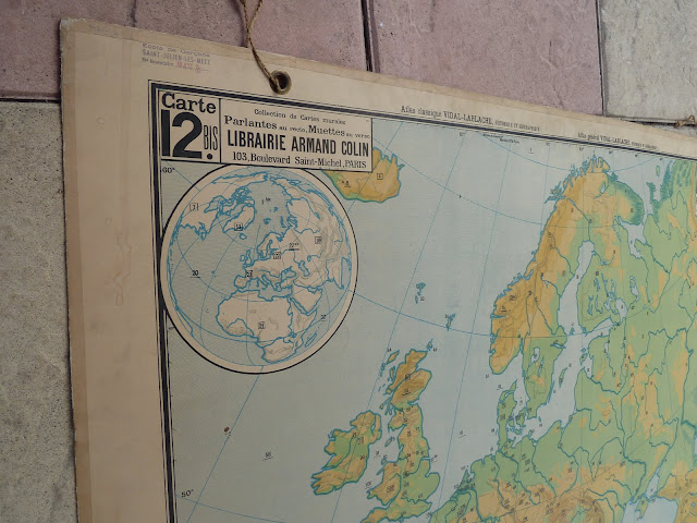
French vintage map Europe 1950
Rare Mid Century Antique French EUROPEAN MAP
Part of a great series of rare French vintage Maps of europe.
The international map has fantastic illustrations of Europe (cities, regions, river).
This ancient french educational map can be used by a teacher or by everyone for hang it in living room
a large & nice art print vintage in your kid's room or in your office.
62 years old hanging on a wall in french school ( NORMANDY)
This international elementary school map is in fabulous shape!
This international elementary school map is in fabulous shape!
About Me & NiceVintageFrance
|
you are free to see Similar Items
| ||||||||||
 | |||||||||||
And Now, Make your Choice !
| Help me | HAPPY BIRTHDAY | Buy now it | ||
| NiceVintageFrance |  | |||
| 6 Years ago | ||||
| To find | Would you like buy this item | |||
| Friend & Customers | Cheaper ? | |||
| OR | STEP 1 : Whish me a happy Birthday ! | OR | ||
| Recommend |
+
| |||
| this place with | STEP 2 : Buy now with this number item | 359$ | ||
| Facebook & Twitter | Number item: Europ50 6yo 300$ | Number item: Europ50 |


